Driving the E10 End to End: Tunnels, Bridges, and the Real Pace of the Day
I’d read, before coming here, that the E10 is “the only road you need.” That’s technically true — it strings together every island in this guide, from Å i Lofoten at one end to the gateway near Narvik at the other — but it doesn’t tell you anything about what a day of actually driving it feels like. I want to get that part down before it blurs into a single memory of tunnels and fjords, because the pace of this road surprised me more than the scenery did, and I’d assumed the scenery was the whole story.
The road is shorter than it looks, and slower than it looks
On a map, the E10 through the main islands doesn’t cover an enormous distance. In practice, I never once drove it at the speed a similar distance would take at home. Between the bridges connecting Vestvågøya, Flakstadøya, and Moskenesøya, the tunnels cutting through the mountains that would otherwise make some of this route impossible, and the sheer number of places worth stopping, a “short” drive routinely became a half-day event. I stopped budgeting drive time in kilometres and started budgeting it in stops, which is a better system here than anywhere else I’ve driven.
Tunnels that you stop noticing, until you don’t
The tunnels are the part nobody mentions until you’re inside one. Some are long, dim, and plain; a few have that odd underwater-adjacent feeling of driving beneath a fjord rather than around it. After the first two or three, I stopped registering them as remarkable — which is exactly the moment I’d suggest staying alert, since a lit tunnel after bright daylight outside does something to your eyes that takes a few seconds to adjust to, and that’s not the moment to be checking a phone for directions.
The bridges, and why I kept pulling over
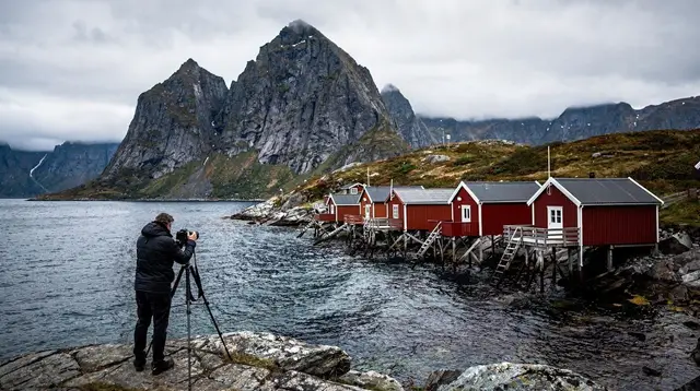
The bridges between islands are where I did most of my unplanned stopping. Nothing about them is engineered as a “viewpoint,” but the approach to several — particularly around Gimsøy and toward Flakstad — opens onto exactly the kind of wide-water, mountain-backed view that this archipelago is known for, and I found it hard to drive past without pulling into whatever shoulder or lay-by was available. If there’s one piece of advice I’d give anyone doing this drive for the first time, it’s to not schedule the day so tightly that these unplanned stops become impossible. They were, more than once, the best part of the day.
Rest stops, fuel, and the towns in between
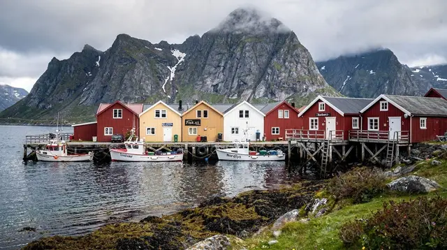
Fuel and food are more spread out here than I expected, and I got into the habit of topping up whenever I passed through a town with a station rather than waiting until the tank ran low — Leknes and Svolvær were the two places I relied on most, being the largest towns along the stretch I drove. Smaller villages like Ballstad and Ramberg had less in the way of services but were worth a slow pass-through regardless, since some of the most photogenic harbour scenes weren’t at the famous stops but at these quieter ones in between.
The stretch toward Å, and turning back
Driving the E10 all the way to its literal end, at Å i Lofoten, felt like a small ceremony in itself — the road just stops at a cluster of preserved fishing buildings and the open sea beyond. I hadn’t expected that to feel significant, but there’s something clarifying about a road that has an actual terminus rather than just fading into a junction. Reine and Hamnøy, a little further back up the road, are the villages I ended up photographing the most, and I understood immediately why they show up in nearly every photo taken of this archipelago.
What I’d change about how I planned the day
If I did this again, I’d build in more slack than I did. My mistake wasn’t underestimating the distance — it was assuming that because the road looked short, the day would be, too. Between tunnels I drove more cautiously than usual, bridges I couldn’t resist stopping at, and villages that turned “passing through” into an hour-long stop without my noticing, the E10 asks for a looser schedule than most roads its length would. Weather played a role too — a clear morning turned overcast by early afternoon on more than one day, which changed both the driving conditions and what was worth stopping for.
On the evening I’d planned to drive straight through, I ended up parked near Kabelvåg instead, having decided the light was too good to keep moving. That decision led, almost by accident, to booking a northern lights tour departing from nearby Svolvær for later that same night — the kind of plan change this road seems to invite rather than resist. On a clearer, calmer evening earlier in the trip, I’d also gone out on a sea eagle and nature safari, which meant one more day where the “drive” part of the day ended earlier than planned, in favour of getting out on the water instead.
What I’d tell someone doing this for the first time
Don’t plan the E10 as a transit route between destinations. Plan it as the destination, with stops built in generously, fuel topped up before you think you need it, and enough flexibility in the schedule that an unplanned pull-off or a changed evening plan doesn’t wreck the rest of the trip. It’s a road that rewards slowing down far more than any itinerary I read before arriving made it sound like it would.
Transport passes & transfers on GetYourGuide
Verified deep-linked GetYourGuide tours. Book through these links and we earn a small commission at no cost to you.
Photos show the destination, not the operator's own images.