The rock that looks back at Svolvær
Look up from almost anywhere in Svolvær and, on a clear day, the skyline is dominated by a jagged spire split into two horns near its top. That’s Svolværgeita — “the Goat” — and it has become something like the town’s unofficial emblem, appearing on postcards and in every photographer’s frame of the harbour. It sits on the mountain directly behind town, high enough that the horns are visible from sea level but far enough up that reaching them is a genuine undertaking, not a stroll.
The name refers to the two summit points, which from certain angles resemble a goat’s horns. What actually draws people up there, though — or at least draws the story that gets repeated about it — is the jump.
The mountain underneath the horns
The horns themselves are only the last, most photographed piece of a much larger mountain that rises directly behind Svolvær’s harbour. Below the technical section, the approach climbs through open, rocky ground that gains height steadily rather than in one dramatic push, and for a good stretch of it the effort is closer to a steep hike than to climbing. The view opens gradually rather than all at once: the harbour and the outer islands come into view first, followed by a wider stretch of Austvågøya as the trail gains elevation, with the twin horns themselves staying out of sight from below until fairly late in the approach. It’s only once hikers are well up the flank that the scale of the spire — and how exposed the final section to the horns actually is — becomes obvious in a way that photographs from town don’t really convey.
What a guided climb actually involves
For visitors without significant local route experience, reaching the horns means going with a qualified mountain guide rather than attempting the technical section independently. A guided day typically covers the approach on foot, the roped climbing section itself, and the return, which together make this a full-day commitment rather than a quick detour from a Svolvær stay. Guides carry and manage the rope and protection gear, and pace the climb to the group’s ability rather than a fixed schedule, since the technical section is short but genuinely exposed. Group size on a guided day tends to stay small by necessity — the technical section only accommodates one climber at a time — which is part of why the overall day takes longer than the short distance covered by the horns themselves might suggest.
Weather is the most common reason a scheduled climb doesn’t go ahead as planned — wet rock changes the route’s difficulty enough that guides will postpone or reroute a day’s plan rather than push forward into deteriorating conditions, which is worth knowing before building a single day around it with no flexibility either side.
The jump between the horns
Svolværgeita’s climbing route ends at the base of the twin horns, and from there, a small number of climbers choose to jump the gap between them: a short leap across open air with a substantial drop below on either side. It is not part of a standard ascent, it is not something any operator will arrange as a matter of course, and it is not attempted casually — it requires the climber to already be an experienced, roped climber who has completed the route itself, at which point the jump is a personal decision rather than a scheduled activity.
It’s worth being direct about what this means for most visitors: the jump is not a bucket-list activity that can be booked. Reaching the horns at all requires technical rock-climbing ability, proper gear, and — for anyone without significant local route experience — a qualified mountain guide. This is not a hike that gains exposure gradually; the final section is climbing in the literal sense, with rope and protection.
Even among climbers who complete the route, most don’t attempt the jump itself. Standing at the base of the first horn with a drop on either side and a short gap to clear is a different proposition from having climbed the rest of the route competently, and plenty of experienced climbers choose to stop there, take in the view, and descend the way they came. That’s not treated as an incomplete outing locally — the climb to the horns is the recognised achievement, and the jump is understood as a separate, optional, and genuinely riskier choice layered on top of it, made in the moment rather than planned in advance.
Seeing it without climbing
None of that rules out a good look at Svolværgeita. The mountain it sits on can be approached on foot from town on trails that climb well up the flank without requiring technical skill, and from various points along that approach, and from spots around Svolvær harbour itself, the twin horns are clearly visible against the sky. A telephoto lens closes the distance further for anyone who wants a detailed shot without the climb.
How far up the approach trail is worth going depends entirely on time and fitness rather than any fixed rule. A short walk from the harbour already puts the spire at a noticeably different angle than the classic postcard view from sea level, while continuing further up the flank trades an easy outing for a longer, steeper one that still stops well short of the technical section. There’s no marked cutoff point where “hiking” becomes “climbing” — the terrain simply steepens and the exposure increases gradually until the rock section makes the difference obvious on its own.
| Way to see Svolværgeita | Effort required | What you get |
|---|---|---|
| From Svolvær harbour | None — just look up | The classic view, spire against the sky, best in clear weather |
| Approach trail partway up the mountain | Moderate hike, marked path | Closer view, elevation over the town and fjord |
| Full climbing route to the horns | Technical climbing, rope, guide recommended | The summit itself, and the option (for experienced climbers only) of the jump |
For most travellers, the first two options deliver the experience that matters — a clear look at one of the archipelago’s most recognisable shapes — without the risk or gear commitment of the full route. Guided climbing in the wider Lofoten area, including routes comparable to Svolværgeita, is covered in more depth in the general guide to climbing in Lofoten, and the best hikes in Lofoten guide lists the approach trail alongside other routes of comparable effort for travellers deciding how it fits into a wider trip.
Photographing the spire
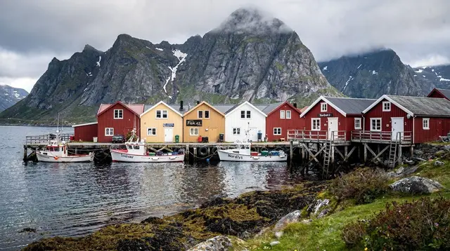
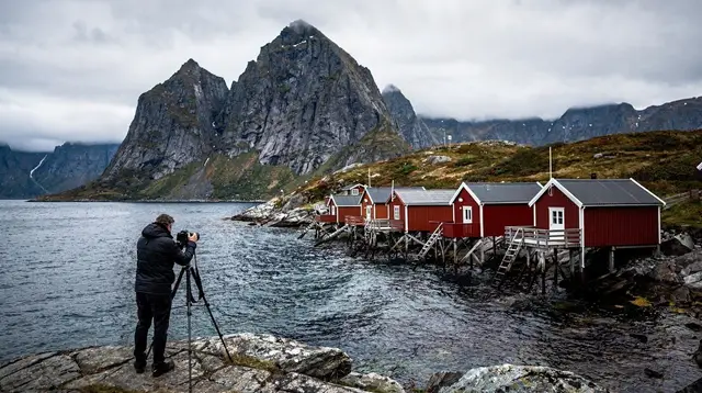
Because Svolværgeita is visible from so many points around the harbour, it’s one of the easier Lofoten landmarks to photograph without any special access. The classic shot works from sea level in town, with the spire framed against the sky or reflected in calm harbour water; a telephoto lens compresses the distance and isolates the horns from the surrounding rock for a tighter composition. Higher up the approach trail, the same shape reads differently — closer, with more of the supporting mountain visible below it, and with the harbour spread out underneath rather than framing the scene from below. The photography guide for Lofoten covers how the archipelago’s light works more broadly across the seasons, which applies just as much to a harbour-level shot of the Goat as it does to any other Lofoten view.
While someone else climbs
Not everyone in a travelling group wants to attempt the technical route, and Svolvær’s position as the archipelago’s main harbour town means there’s no shortage of ways to fill a day at sea level while others are up on the mountain. A boat-based sea eagle and nature safari works the coastline around town and toward the Trollfjord, covering some of the same water visible from partway up the approach trail but from the opposite direction. For a slower-paced option, a local guided fishing trip out of Svolvær fills the same window with a different kind of activity, timed to run independently of whatever schedule the climbing group is on. Either option means a full day doesn’t have to hinge on everyone in the group wanting to climb.
Weather and timing
The approach trail and the climbing route are both weather-dependent in a way that’s easy to underestimate this far north. Wind picks up with elevation, cloud can settle over the upper mountain even when the harbour below is clear, and wet rock changes the climbing route from manageable to genuinely dangerous. Summer offers the most reliable combination of dry rock and long daylight — with the archipelago’s midnight sun window running roughly from late May to mid-July, there’s no pressure to start at dawn. Outside summer, shorter days and wetter, colder rock make the technical route a much narrower proposition, best left to those with strong local knowledge of current conditions.
Even the lower approach trail changes character across the year: the Gulf Stream keeps Lofoten’s winters comparatively mild for this latitude, generally somewhere around 0 to minus 3 degrees Celsius, but snow and ice can still linger on the upper flank well after the harbour itself has cleared, turning a straightforward walk into something that calls for proper footwear and a more cautious pace.
Anyone heading up the approach trail, even without climbing intentions, should treat it like any other Lofoten hike: check the forecast that morning rather than the night before, since conditions here can change within the hour, and carry layers regardless of how the weather looks at sea level. General safety practices for hiking in this terrain are covered in the hiking safety guide, and they apply just as much to an approach hike below Svolværgeita as to any of the archipelago’s other trails. The weather guide for Lofoten covers how conditions shift month to month across the archipelago, which is worth reading before locking in a single day for either the viewpoint hike or a guided climb, since either is easier to reschedule than to push through in deteriorating weather.
Getting to the trailhead itself is straightforward from central Svolvær, whether on foot or by a short drive — see getting around Lofoten for the basics of moving around this end of Austvågøya without a fixed schedule getting in the way.
Where it fits with the rest of a Svolvær visit
Svolværgeita sits directly above the town, which makes it an easy addition — at least as a viewpoint — to a stay based in Svolvær rather than a special trip in its own right. Visitors splitting time between the harbour, Kabelvåg a little further along, and the outer sights toward Henningsvær or Trollfjord will likely see the spire repeatedly from different angles without any extra planning. It’s one of the few Lofoten landmarks that rewards simply staying in one town for a couple of days and noticing how the view changes with the light — including after dark in the darker months, when clear nights around Svolvær occasionally bring the northern lights over the same skyline.
A guided northern lights tour departing from Svolvær is one practical way to chase that combination on a clear winter night, tracking open sky rather than waiting to see whether it clears directly over town.
Visitors with a boat trip already on their itinerary, such as one of the boat trips from Svolvær toward the Trollfjord, will often get a passing view of Svolværgeita from the water on the way out of the harbour, adding yet another angle on the same spire without any extra time set aside for it specifically.
Questions about Svolværgeita
Can anyone climb Svolværgeita?
No. The route to the summit horns is a technical rock climb requiring rope, gear, and prior climbing experience. It is not suitable for casual hikers, and most visitors without a climbing background should not attempt it without a qualified guide.
What is the famous jump at Svolværgeita?
It’s a short leap across the gap between the spire’s two summit horns, attempted only by climbers who have already completed the technical route and who choose to do it as an additional, unofficial act — not a standard part of any guided tour.
Do I need to climb to see Svolværgeita properly?
No. The spire is clearly visible from Svolvær harbour and from several points along the approach trail partway up the mountain, both of which require no technical climbing ability.
What’s the best time of year to view or climb Svolværgeita?
Summer (June to August) offers the driest rock and the longest daylight, which matters for both the technical climbing route and a comfortable approach hike.
Is there a marked trail toward Svolværgeita?
Yes, a hiking trail climbs partway up the mountain from near Svolvær, offering elevated views without requiring rock-climbing skills; the final technical section to the horns themselves is separate and requires climbing gear.
How visible is Svolværgeita from the town centre?
Very — on a clear day, the twin-horned silhouette is visible from most open points around Svolvær harbour, making it one of the easiest landmarks in the archipelago to view without any extra effort.